Transit and Climate Adaptation = Transit and Equity

Who will you meet?
Cities are innovating, companies are pivoting, and start-ups are growing. Like you, every urban practitioner has a remarkable story of insight and challenge from the past year.
Meet these peers and discuss the future of cities in the new Meeting of the Minds Executive Cohort Program. Replace boring virtual summits with facilitated, online, small-group discussions where you can make real connections with extraordinary, like-minded people.
Transportation infrastructure is a significant part of the landscape and shapes human settlement. Transportation is about place, shaping place, and getting from one place to another. Climate adaptation is also about place, and how populations deal with the extreme weather events that occur in particular geographies or places. When the place in which one resides not only lacks the necessary resources, but also lacks the transportation systems that allow access to resources in other areas and the ability to escape disaster or its aftermath, it renders its inhabitants without transportation vulnerable. As Robert Bullard states in the book Race, Place and Environmental Justice after Hurricane Katrina, “When a location lacks access to technology, communication, and transportation, and when the residents of that location lack financial means to overcome these issues, this also renders the location geographically vulnerable.” Dr. Bullard is speaking, in this instance, about the thousands of residents who had no means to get out of the City of New Orleans during Katrina, due to the lack of affordable and available transportation. His statement speaks to the reality of many residents who are spatially segregated in Transit Desert communities and suffer place based environmental and transit vulnerability.
Transit Deserts are about place, access, and equity. They are characterized by transit dependent populations, lack of transit access and a particular geographic or physical form. Most urban dwellers assume the availability of transit, not thinking of those in the outer urban neighborhoods, ring suburbs, low lying geographies or other areas of the city that lack efficient public transportation access. Although a substantial number of people in urban areas own a vehicle (Bullard and Wright, 2009), there are also additional forms of public transportation including taxi cabs, ride sharing services, subways, light rail, or other forms of mass transit available in most inner urban areas. These additional forms of transportation are often in the urban core, or are regulated to particular corridors and routes, yet there are many urban, outer urban, and suburban areas where public transportation is not frequent, easily accessible or even nonexistent, making them vulnerable.
Extreme weather events have severe impacts on vulnerable communities and their transportation infrastructure. In many cases evacuation out of flooded areas is difficult due to lack of adequate transportation infrastructure. Access to transportation is critical or lifesaving before, during and after extreme weather events. Before Hurricane Katrina many people opted to stay, even though a mandatory evacuation was issued. Some of these people remained due to a lack of transportation needed for evacuation. Had there been public transportation linking to train, air and other major routes out of the city, some of those who remained behind may have left even before the evacuation became mandatory. Existing public transit can come to a halt during a storm event, but because areas with existing transit have a form conducive to routing, vehicle access and picking up passengers, these areas are can accommodate emergency buses and other forms of transportation much easier during storm events. Transit access is also important for low income families whose cars get damaged during an extreme weather events, and who cannot afford to immediately replace them. This causes difficulty at the time of recovery, and for everyday commuting to reach various services in everyday life.
Communities without transit accessible form, therefore not physically suited to buses and public transportation vehicles, will have difficulty accommodating such modes when needed during emergencies. For communities such as these, a vulnerability assessment should be undertaken.
A vulnerability assessment can be undertaken by combining storm surge and extreme rainfall projections with transit availability characteristics to assess geographic vulnerability in regards to transit access and equity. During floods, in particular geographies, there is no means of evacuation, due to the lack of affordable and available transportation. Thus, there is an urgent need to evaluate the vulnerability of transportation infrastructure and mass transit in relationship to climate change and extreme weather events. For this purpose the following data should be mapped:
- Storm surge and extreme rainfall projections
- Demographic data, including income levels, and vehicle ownership
- Geographic data
- Transit access data, including routes, and stop locations.
The importance of this assessment is to provide information and data that can be used in creating effective policy that impacts transit access for those that are vulnerable during storm events.

Houston Metro Area. Niveditha Das Gangadhar, University Texas, Arlington funded by CTEDD.
Climate change is most evidenced in extreme weather events, and vulnerable communities are most impacted, often due to lack to transportation. Therefore, to address climate adaptation one of the key components is to address transportation equity. Those in vulnerable communities must have additional measures taken to provide equal opportunities for climate adaptation.
The following recommendations come from the American Society Louisiana of Landscape Architecture (ASLA) Blue Ribbon Panel on Climate Change and Resiliency Report and the Transportation Sustainability Guide. These recommendations address policy and planning to address transportation.
- Require transit-oriented development, including affordable housing, with multimodal green and complete streets.
- Provide equitable access to transportation options, including safe, connected pedestrian, bicycle, and transit routes.
- Anticipate, plan, and provide infrastructure to support electric vehicles and new transportation methods and technologies.
- Apply technologies and design strategies to achieve net-zero
- Promote regional transportation planning and development.
The next list of recommendations are also from the ASLA Blue Ribbon Panel on Climate Change and Resiliency Report to address climate adaption and equity for vulnerable communities.
- Assess and address climate impacts on vulnerable communities.
- Focus on environmental justice and equitable access to transportation, housing, jobs, and recreation and open space.
- Develop relocation, retreat, and/or evacuation plans.
- Limit, adapt, or prohibit building in floodplains to protect life, property, and floodplain function.
- Update Federal Emergency Management Agency flood maps and include projections of climate change impacts.
- Promote mixed-income housing and mixed-use development that provides easy access to essential services.
- Establish/increase low-income and new market tax credits.
Priority should be given to policies that address transit access before during and after catastrophic weather events. Access to mass transit will help in the time of evacuation, during the event for emergency purposes and after the event for quick recovery. Priority should be given to build transportation infrastructure in areas with reoccurring flooding making it easier for the people to evacuate. This will only occur and truly be affective if we address equity. To address equity, a transfer of knowledge should occur. This should include:
- Increasing public awareness of storm-water management impacts,
- Providing community residents with information on homeowner resources related to resilience and hazard mitigation in general
- Providing information regarding the communities’ geographic vulnerability
- Providing knowledge of transit routes and access.
Discussion
Leave your comment below, or reply to others.
Please note that this comment section is for thoughtful, on-topic discussions. Admin approval is required for all comments. Your comment may be edited if it contains grammatical errors. Low effort, self-promotional, or impolite comments will be deleted.
Read more from MeetingoftheMinds.org
Spotlighting innovations in urban sustainability and connected technology
Middle-Mile Networks: The Middleman of Internet Connectivity
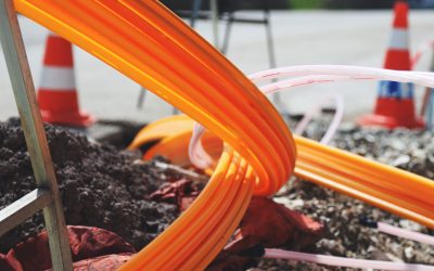
The development of public, open-access middle mile infrastructure can expand internet networks closer to unserved and underserved communities while offering equal opportunity for ISPs to link cost effectively to last mile infrastructure. This strategy would connect more Americans to high-speed internet while also driving down prices by increasing competition among local ISPs.
In addition to potentially helping narrow the digital divide, middle mile infrastructure would also provide backup options for networks if one connection pathway fails, and it would help support regional economic development by connecting businesses.
Wildfire Risk Reduction: Connecting the Dots
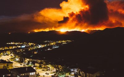
One of the most visceral manifestations of the combined problems of urbanization and climate change are the enormous wildfires that engulf areas of the American West. Fire behavior itself is now changing. Over 120 years of well-intentioned fire suppression have created huge reserves of fuel which, when combined with warmer temperatures and drought-dried landscapes, create unstoppable fires that spread with extreme speed, jump fire-breaks, level entire towns, take lives and destroy hundreds of thousands of acres, even in landscapes that are conditioned to employ fire as part of their reproductive cycle.
ARISE-US recently held a very successful symposium, “Wildfire Risk Reduction – Connecting the Dots” for wildfire stakeholders – insurers, US Forest Service, engineers, fire awareness NGOs and others – to discuss the issues and their possible solutions. This article sets out some of the major points to emerge.
Innovating Our Way Out of Crisis
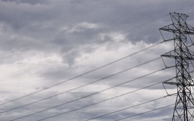
Whether deep freezes in Texas, wildfires in California, hurricanes along the Gulf Coast, or any other calamity, our innovations today will build the reliable, resilient, equitable, and prosperous grid tomorrow. Innovation, in short, combines the dream of what’s possible with the pragmatism of what’s practical. That’s the big-idea, hard-reality approach that helped transform Texas into the world’s energy powerhouse — from oil and gas to zero-emissions wind, sun, and, soon, geothermal.
It’s time to make the production and consumption of energy faster, smarter, cleaner, more resilient, and more efficient. Business leaders, political leaders, the energy sector, and savvy citizens have the power to put investment and practices in place that support a robust energy innovation ecosystem. So, saddle up.


0 Comments