Decision Making Strategies for Urban Adaptation

Who will you meet?
Cities are innovating, companies are pivoting, and start-ups are growing. Like you, every urban practitioner has a remarkable story of insight and challenge from the past year.
Meet these peers and discuss the future of cities in the new Meeting of the Minds Executive Cohort Program. Replace boring virtual summits with facilitated, online, small-group discussions where you can make real connections with extraordinary, like-minded people.
Cities today have to make difficult choices around urban adaptation. There are currently too many tasks, too many options, too many alternative scenarios for cities to “see” solutions without access to data. The Urban Adaptation Assessment (UAA) is a tool designed to make local level choices easier to visualize and articulate.
Exploring Future Climate Costs and Current Vulnerabilities
Developed by researchers at the University of Notre Dame, the UAA provides data on vulnerability, risk, and readiness for 278 cities across the United States and Puerto Rico, with populations of at least 100,000. The UAA measures a city’s risk and readiness on over 40 indicators divided into six categories (exposure, adaptive capacity, sensitivity, government, social and economic), along five climate hazards – extreme heat, extreme cold, drought, flooding and sea level rise.
At the city level, the tool provides estimates of the likelihood of experiencing a particular hazard in the year 2040 along with projected costs associated with that hazard.
For example, according to the UAA, Charleston, SC has a low probability of experiencing a flood in 2040, but the expected cost of a flood if it happened could be upwards of $16 million. These projections are based on NOAA data for flood events and the modeling of historical flood cost data. So for a given level of risk, Charleston assumes a rather costly expenditure if that uncertain – but low probability – flood arrives. Moreover, Charleston is a coastal community subjected to the potential consequences of sea level rise. The UAA tool suggests that in 2040 at NOAA’s intermediate level sea-level rise scenario, they will face a 1.2 foot SLR that costs well over a billion dollars.
All of the future scenarios provided by the UAA are based on advanced modeling drawing from a climate scenario represented by the Representative Concentration Pathway (RCP) 4.5, which by today’s standards is a rather optimistic projection. This was intentional. An alternative would be to use climate scenarios based on RCP 8.5 that would show a much direr situation. The ‘doom and gloom’ approach of RCP 8.5 might be where cities end up, but in the short term, the estimated costs would be so high that it might leave city managers with choices that look to be impossible.
The View from the Neighborhood-Level
One of the pressing questions about city level adaptation efforts is that the harm from climate hazards can be agnostic with regard to the distribution of the population, yet climate adaptation efforts are not. This leaves city planners to confront the question of where best to deploy limited resources so that they can have the greatest impact on social equity.
To allow city managers to ‘see’ how social, physical and demographic vulnerability is distributed across their city, the UAA provides data at the level of the neighborhood, using census tract data. For each census tract, we provide demographic data on medium household income and ethnic or cultural representation; we allow the user to then overlay aspects of the city’s built environment and social vulnerabilities at that census tract, such as single mothers, access to vehicles, housing instability, building age or infrastructural conditions.
The relationship between local vulnerability and climate hazards should be of concern to a city’s elected officials. It’s not hard to see who was most harmed in the Katrina flooding or the recent hurricane in the Florida Panhandle. The distribution of those costs in terms of lives tend to follow aspects of social vulnerability, where the low income or the single parent without a car cannot flee. The UAA allows community leaders to juxtapose potential harm with vulnerable populations.
Access to the UAA
So, can cities make the best decisions from a range of complex choices about critical problems without access to data that clarifies and simplifies the process? The technical answer is yes you can, but the practical answer is that the data will make choices more efficient and outcomes more effective. This need is the premise behind the Urban Adaptation Assessment – a free, open-source tool that provides data in a user-friendly format.
Resources matter in today’s world. While many larger cities can hire robust staffs to manage the exploration of likely outcomes and alternatives, other cities have fewer resources and less depth to invest in understanding some of the knotty problems that climate change generates.
We think the largest and most resource endowed cities will find significant value in the accessibility provided by the UAA and in that sense, it becomes a supplemental tool, one that shows them data and relationships in new light. For example, those within Miami, FL know that the city is at risk from seal-level rise but our the UAA shows residents where and at what cost in the year 2040, allowing officials to build on what they know to prescribe projects that confront the inevitable changes. To smaller and less well-endowed cities, the UAA provides a first line of access to questions of risk and readiness from climate change and for adaptation. The UAA provides these communities access to climate hazard projects and local vulnerability that otherwise would be more elusive.
Additionally, not all cities confront hazards equally. One community might be more susceptible to drought, while another to flood. The tool breaks out various risks to allow for local attention to the hazard that is of greatest concern to a specific community. It’s important to remember that what might seem most salient to a city leadership may mask a more pressing future hazard. A drought may seem to be more central today, but without access to data on climate hazard projections, a city might miss the potential implications of, say, a flood to their community. Spending limited resources to adapt to a potential drought hazard may leave a city increasingly at risk from a flood, and vice versa. The UAA tool aims to foster discussions at the community level with local data and local estimates for the cost of inaction.
The UAA tool is the first of its kind that provides comprehensive city and neighborhood data across five climate hazards and incorporates all US cities with populations over 100,000. In a unique way, the tool packages for civic leaders, a description of their social, political and infrastructural strengths and weaknesses in the face of climate change, allowing them to see the extent of their projected exposure to a given climate hazard.
Under conditions where planning for climate adaptation is imperative (IPCC and US National Climate Assessment), Notre Dame is proud to provide a mechanism that allows cities to explore climate hazards with minimal investment. Begin exploring your city’s data today at gain.nd.edu/urban.
Discussion
Leave your comment below, or reply to others.
Please note that this comment section is for thoughtful, on-topic discussions. Admin approval is required for all comments. Your comment may be edited if it contains grammatical errors. Low effort, self-promotional, or impolite comments will be deleted.
1 Comment
Submit a Comment
Read more from MeetingoftheMinds.org
Spotlighting innovations in urban sustainability and connected technology
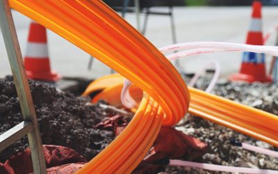
Middle-Mile Networks: The Middleman of Internet Connectivity
The development of public, open-access middle mile infrastructure can expand internet networks closer to unserved and underserved communities while offering equal opportunity for ISPs to link cost effectively to last mile infrastructure. This strategy would connect more Americans to high-speed internet while also driving down prices by increasing competition among local ISPs.
In addition to potentially helping narrow the digital divide, middle mile infrastructure would also provide backup options for networks if one connection pathway fails, and it would help support regional economic development by connecting businesses.
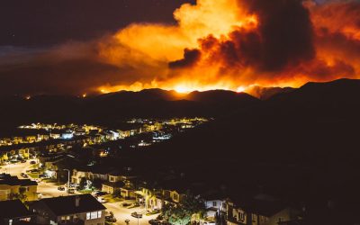
Wildfire Risk Reduction: Connecting the Dots
One of the most visceral manifestations of the combined problems of urbanization and climate change are the enormous wildfires that engulf areas of the American West. Fire behavior itself is now changing. Over 120 years of well-intentioned fire suppression have created huge reserves of fuel which, when combined with warmer temperatures and drought-dried landscapes, create unstoppable fires that spread with extreme speed, jump fire-breaks, level entire towns, take lives and destroy hundreds of thousands of acres, even in landscapes that are conditioned to employ fire as part of their reproductive cycle.
ARISE-US recently held a very successful symposium, “Wildfire Risk Reduction – Connecting the Dots” for wildfire stakeholders – insurers, US Forest Service, engineers, fire awareness NGOs and others – to discuss the issues and their possible solutions. This article sets out some of the major points to emerge.
Innovating Our Way Out of Crisis
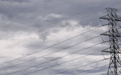
Whether deep freezes in Texas, wildfires in California, hurricanes along the Gulf Coast, or any other calamity, our innovations today will build the reliable, resilient, equitable, and prosperous grid tomorrow. Innovation, in short, combines the dream of what’s possible with the pragmatism of what’s practical. That’s the big-idea, hard-reality approach that helped transform Texas into the world’s energy powerhouse — from oil and gas to zero-emissions wind, sun, and, soon, geothermal.
It’s time to make the production and consumption of energy faster, smarter, cleaner, more resilient, and more efficient. Business leaders, political leaders, the energy sector, and savvy citizens have the power to put investment and practices in place that support a robust energy innovation ecosystem. So, saddle up.


This is a very useful tool! Great information on the state of our city and how it compares with others. Most useful is knowing how likely climate events will be and how much they could cost. The cost of prevention can then be evaluated, making it more likely to invest in prevention that will reduce the cost and pain of disasters. Why would any city not use this tool?